
Welcome to Torry Ecomuseum Project’s interactive pictorial timeline of the changing face of the coastal and waterway environment around Torry. Be part of this collective timeline-making through contributing your photos and stories relating to Torry’s coast and waterways, as well as the natural and built environment spanning many thousands of years.
写真タイムライン
トリー・エコミュージアム・プロジェクトの「写真タイムライン」へようこそ。トリーの海岸や水路、自然環境や建築環境に関連するあなたの写真やストーリーを投稿して、この何千年もの歴史をめぐる年表作りに参加してみませんか?
![]()

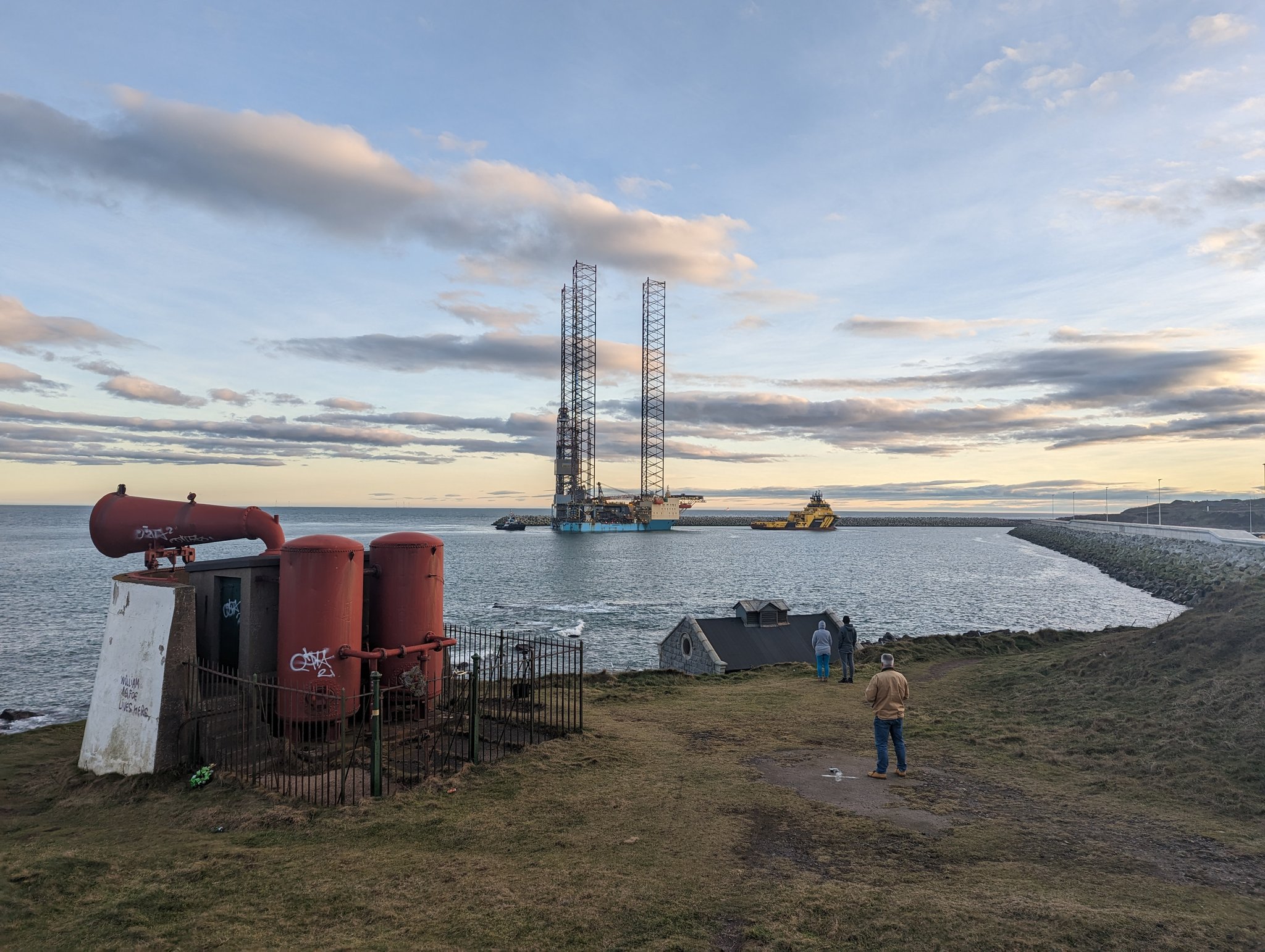
“An oil rig arrives at the new Aberdeen South Harbour today. Nearby St Fittick’s Park is likely to be destroyed by the energy development associated with the harbour.” Photograph and story by Dr Andrew Whitehouse
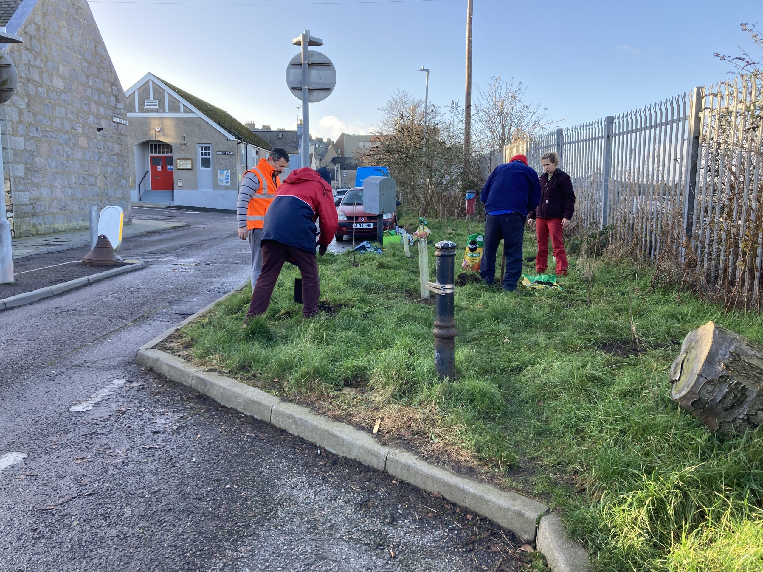
Today, 9 volunteers planted nearly 60 young trees in Torry. Thank you very much for all who turned up and helped. Thank you also Rachel Maurice at Aberdeen Climate Action for organising the session. The footage from today’s planting session will be shared in this season’s Torry-Yubari Exchange. The theme..Read More
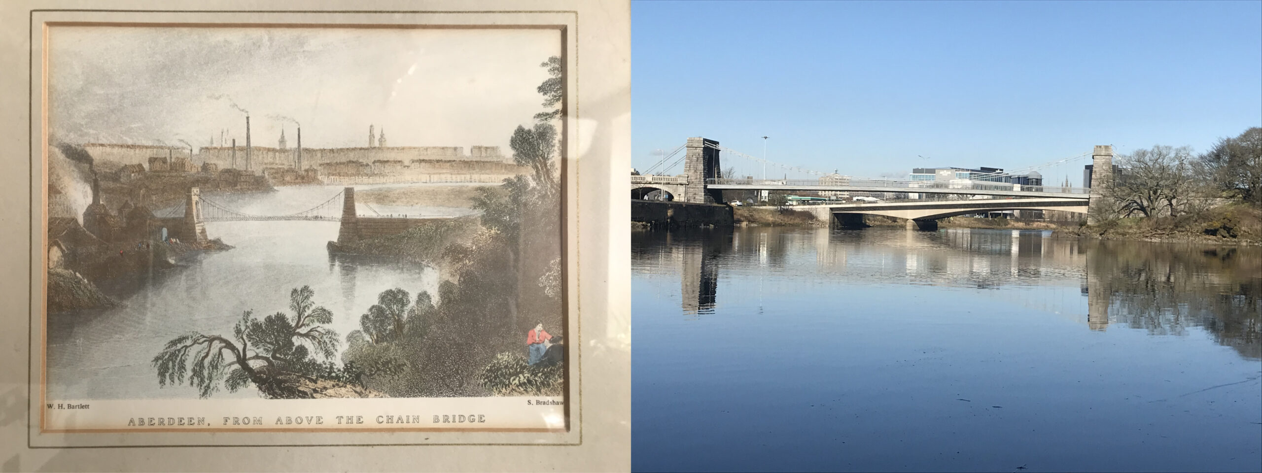
The Wellington Suspension Bridge, also known as the Chain Bridge was opened in 1831 that enabled carts and carriages to cross the River Dee from Kincardineshire into the City of Aberdeen; Torry did not form part of the city of Aberdeen until an Act of Parliament in 1891. The overgrowth of..Read More
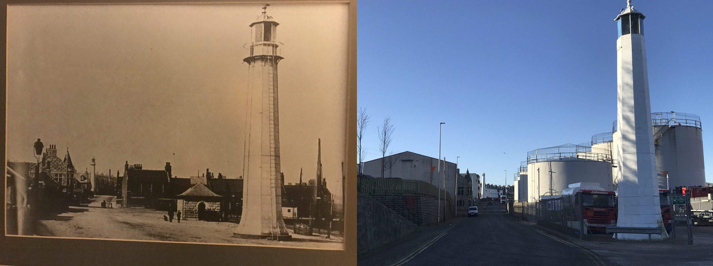
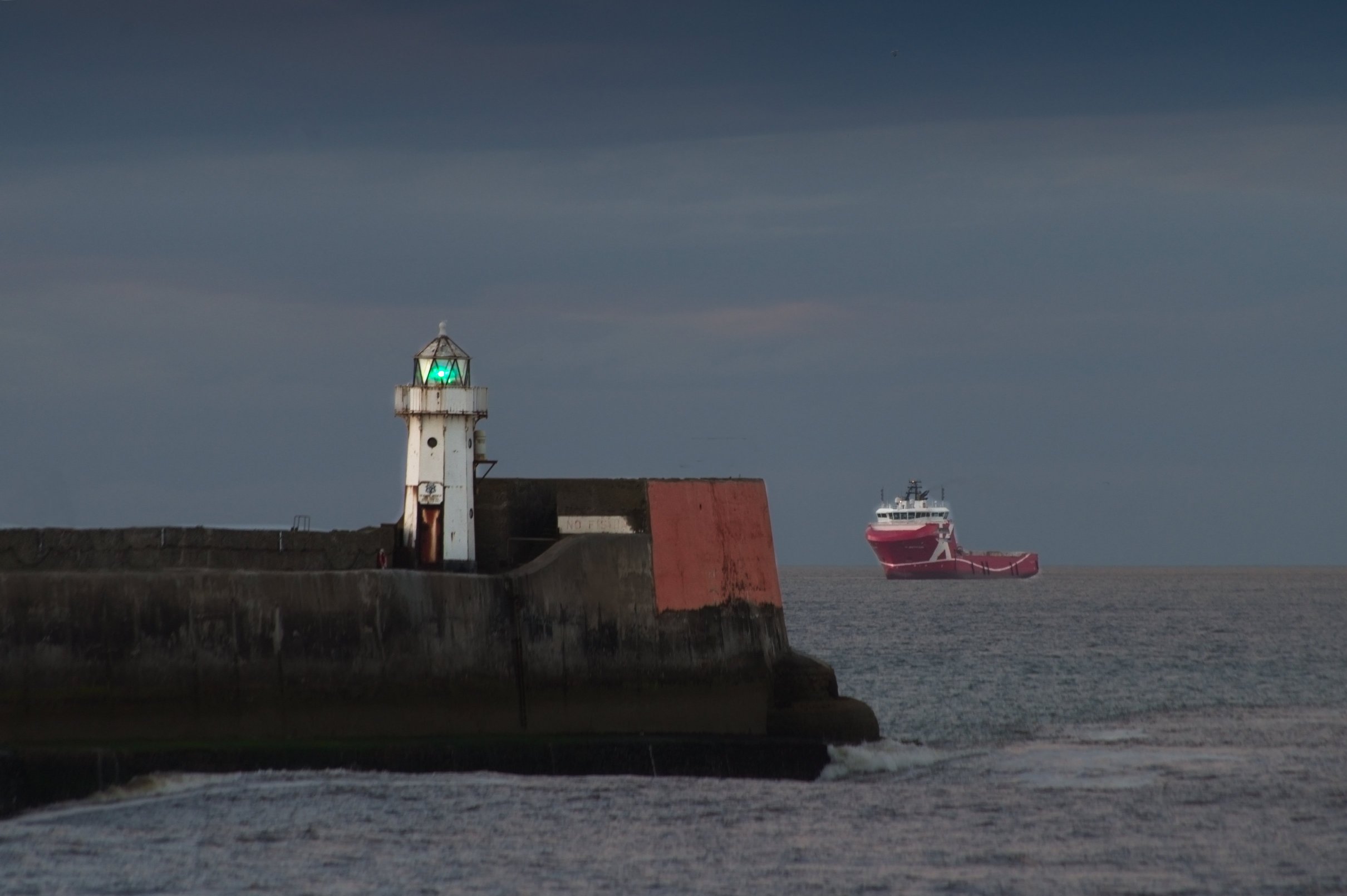
These cast-iron structures help any approaching ship to position itself in the centre of the channel into the harbour, are the earliest surviving pair of cast iron light towers in Scotland and are among the oldest in the world. The photographs were taken on 10th May 1842 (left) and on..Read More

Sand martin flying over goosanders.
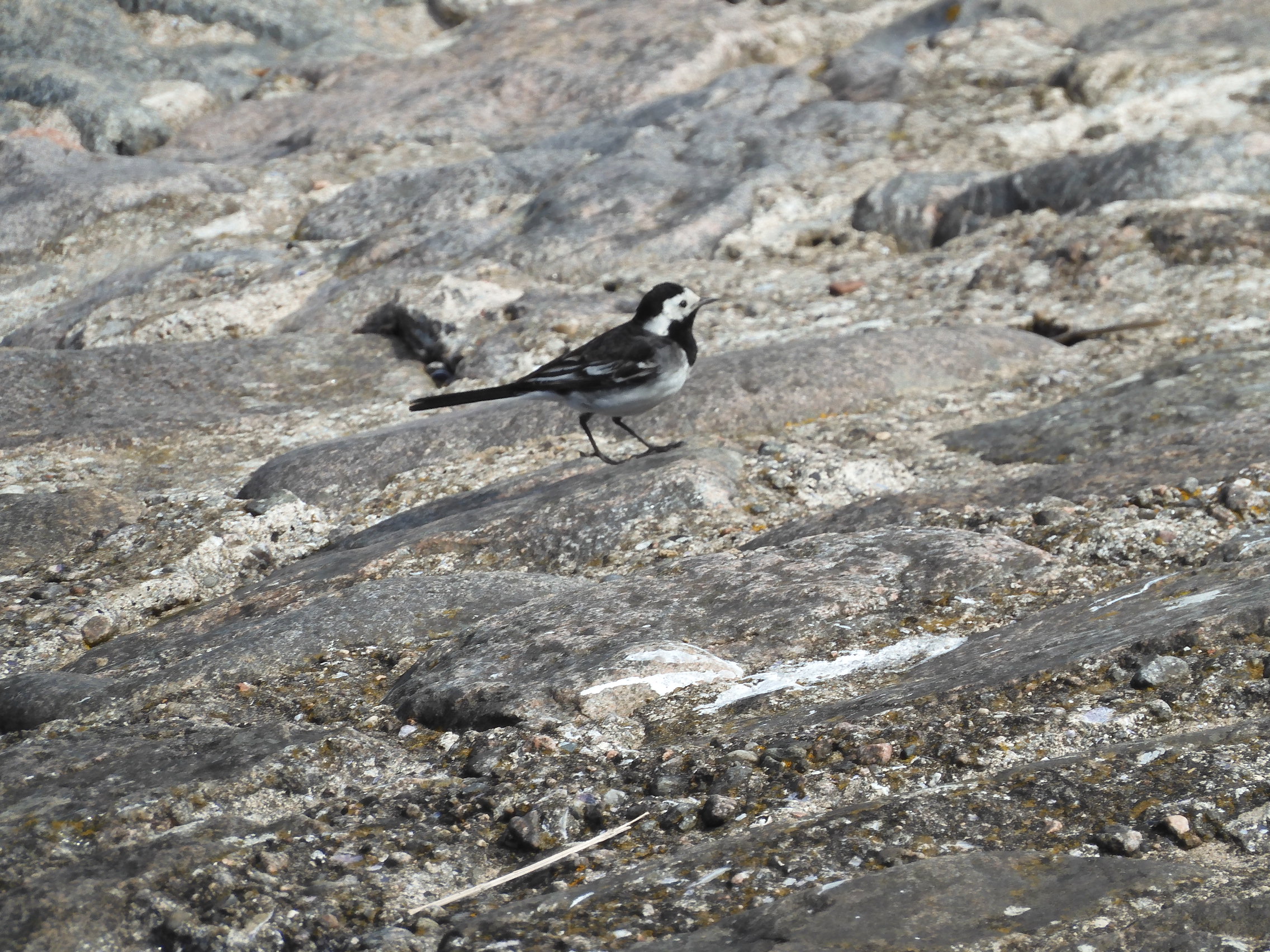
Pied wagtail on pier.
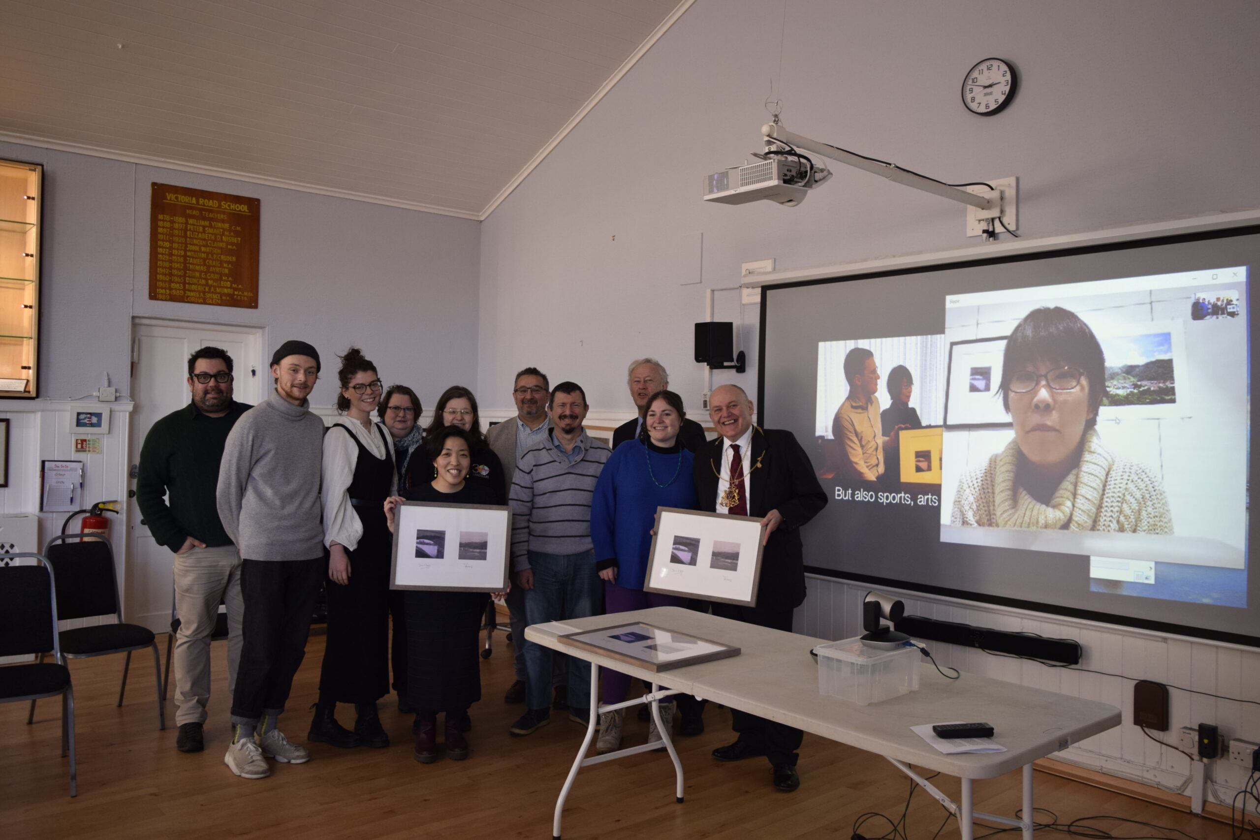
On 9th February 2020, we had a work gifting ceremony of “Aberdeen // Yubari” project at the Old Torry Community Centre. With lovely local residents, Dr Nuno Sacramento (Peacock Visual Arts), Barney Crockett (Lord Provost of Aberdeen), David Fryer (Aberdeen participant, and The Old Torry Community Centre), and Manami Sato..Read More
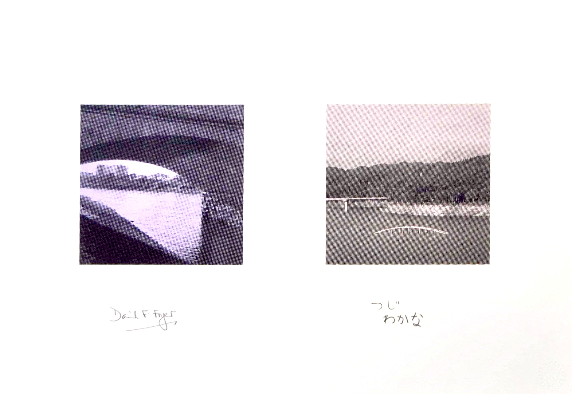
This is a resulting print work of the “Aberdeen // Yubari” project 2019-2020. It was a printmaking project connecting community and context of two cities built around energy – Aberdeen, Scotland and Yubari, Japan. Yubari is known as a former coal mining city. To produce a limited edition print work..Read More
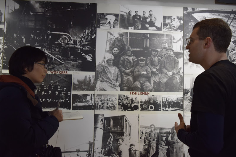
Dr Leslie Mabon (Scottish Association for Marine Science, and Future Earth Coasts Fellow) explaining the maritime history of Aberdeen and surrounding areas to Manami Sato (Director of Shimizusawa Project in Yubari, Japan). In the Maritime Museum, during Manami’s one-week site-visit to Aberdeen from 13th to 19th November 2018. https://wagonart.org/2018/12/07/report-manami-satos-one-week-site-visit-in-aberdeen-en/
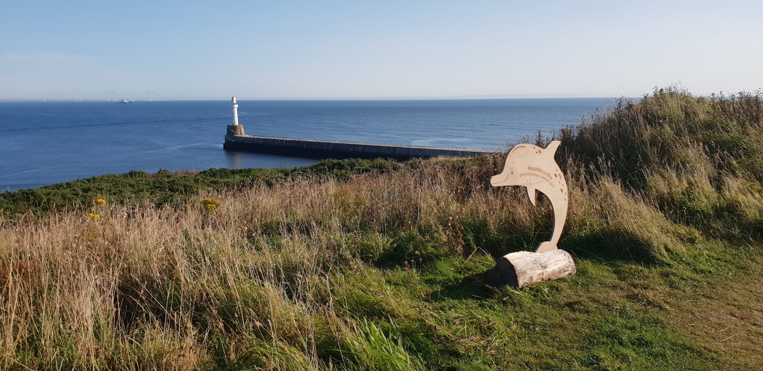
Greyhope Bay was founded in 2016 by Fiona McIntyre. Based in Torry, a community built around an old fishing village, the project aims to connect and engage communities with the marine wildlife, environment and heritage on Aberdeen’s doorstep. To find out more on Greyhope Bay, please visit: https://www.greyhopebay.com/
Bay of Nigg, before the start of construction of the new Harbour project. A regular walk for my family with the dog 1978 till the day that works started, I have so many fond memories of times spent here in all weathers.

“Torry Sound Project: Navigations” team meeting (with project artists Gemma Connell and Angela Main, Caroline Gausden from SonADA and Elspeth Winram from Aberdeen City Council) at Campbell’s Bar on Sinclair Road. The popular local bar with a coastal view was sadly closed in the summer 2016. TSP was an artist-in-residency..Read More
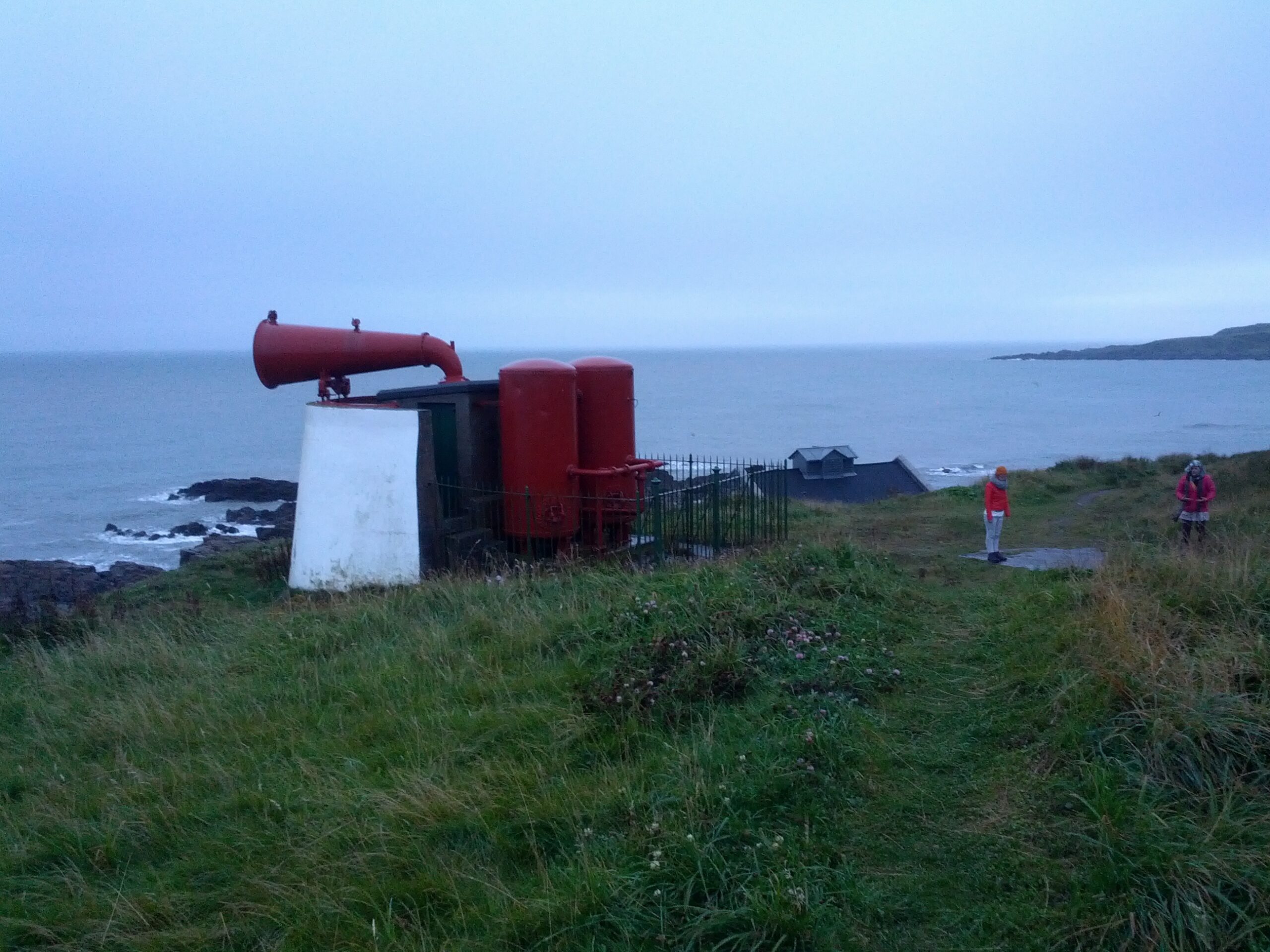
Gemma Connell and Angela Main’s performance scene at the “Torry Coo” foghorn, as part of the “Torry Sound Project: Navigations” in 2015. “Torry 24” was a 24-hour performance across 24 locations in Torry over 13-14 September 2015. This was developed and performed by the project artists Gemma and Angela as..Read More
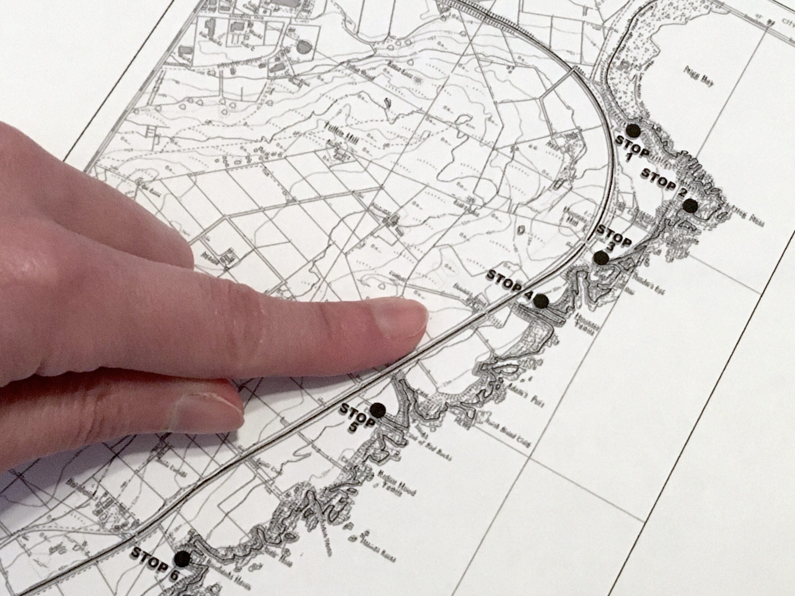
The “Nigg–Cove Coastal Trail”, which traces the geological significance of the coastal area around Torry through 7 stops, was published by Professor Alastair Dawson of University of Aberdeen in 2009. Why don’t you try and walk along this coastal trail to (re)discover Torry’s different dimensions and landscapes spanning over millions..Read More
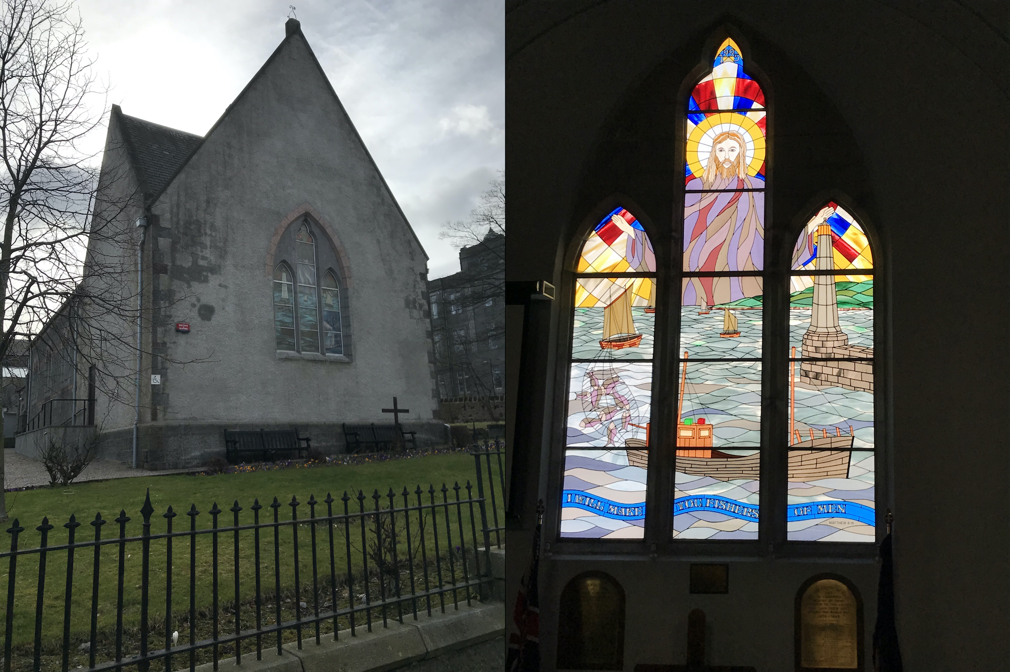
Torry is one of the oldest settlements in the North East of Scotland with over 1000 years of recorded history. The stained glass windows were installed in 1995 to commemorate the 500th Anniversary of Torry being granted the status of a Royal Burgh in 1495 and have both a local..Read More
It was incorporated into Aberdeen in 1891, after the construction of the Victoria Bridge, itself made possible by the 1871 channelling of the River Dee which had previously followed an unstable course to the sea. The channelling also enabled further expansion of the harbour.

The Torry Battery is an artillery battery near Torry in Aberdeen, Scotland, which has overlooked the city’s harbour since 1860. It was originally constructed for nine guns with a defensible barracks at the rear. In 1881 the battery mounted three 10-inch Smooth bore guns and five 68-Pounder Smooth bore guns.
Leading Light, North Pier. Taken from Greyhope Road. July 2020. This is one of two “Leading Lights” designed to aid navigation into Aberdeen Harbour. It is situated at the end of the North Pier, while the other is situated on Sinclair Road in Torry. Line the two lights up, and..Read More
These cast-iron structures help any approaching ship to position itself in the centre of the channel into the harbour, are the earliest surviving pair of cast iron light towers in Scotland and are among the oldest in the world. The photographs were taken on 10th May 1842 (left) and on..Read More
The Wellington Suspension Bridge, also known as the Chain Bridge was opened in 1831 that enabled carts and carriages to cross the River Dee from Kincardineshire into the City of Aberdeen; Torry did not form part of the city of Aberdeen until an Act of Parliament in 1891. The overgrowth of..Read More
From: Leslie Mabon
c.AD 650
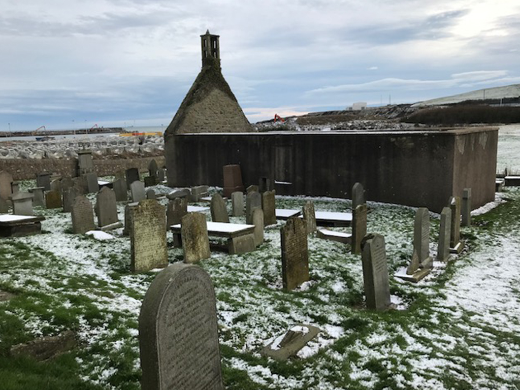
Remains of St Fittick’s Church are located in a field by the community play park, overlooking both the natural landscape of the Bay of Nigg and cultural landscape of residential buildings.
The church is dedicated to St Fittick, who, according to legend, was shipwrecked and scrambled to shore at the Bay of Nigg c.AD 650 to convert the locals, and refreshed himself at a spring, which became a religious foundation known as St Fittick’s Well. Yet, there is no evidence that such a person called St Fittick existed in history. Rather it is believed that St Fittick must have been an amalgam of two other saints: St Fotin and St Fiacre.
This former parish church of Nigg, founded between 1189 and 1199.
Photography: David Fryer
References:
Aberdeen City Historic Environment Record
https://online.aberdeenshire.gov.uk/smrpub/master/detail.aspx?tab=main&refno=NJ90SE0001
Undiscovered Scotland website
https://www.undiscoveredscotland.co.uk/aberdeen/stfitticks/index.html
Doric Columns blog
https://doriccolumns.wordpress.com/welcome/the-royalty/old-torry/
From: David Fryer
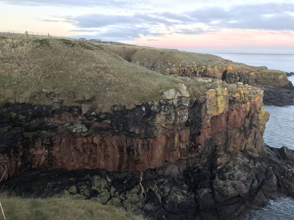
BC15000
One of the amazing insights into historic Earth. In the inlet here we can see clear traces of the igneous activity that took place during the time of the Caledonian mountain building period (in contrast to the younger period of volcanic activity that took place during the Carboniferous period). The evidence consists of a thick (5 m) sill composed of felsite rock. The sill can be seen on both sides of the inlet with its top surface mostly buried by glacial deposits. In some places the sill can be observed as occurring both beneath and above the Dalradian rocks through which it was squeezed. The felsite sill is not restricted to this inlet – it also can be traced southwards along the coast for over 300m.